Automated Flood Extents using SAR Imagery
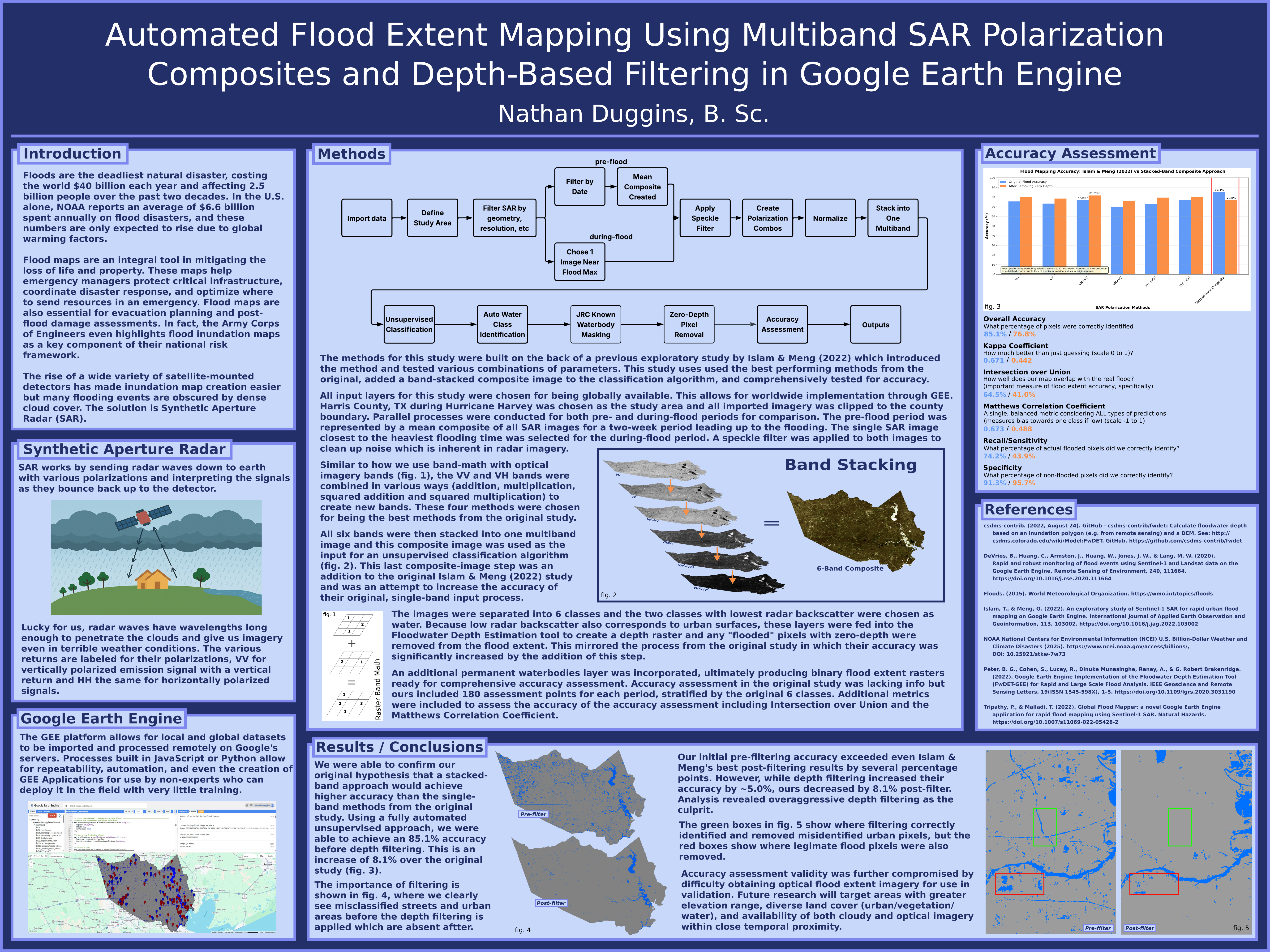
I advanced automated SAR flood mapping research by building on Islam and Meng’s 2022 study of band combinations and supervised classification. Working in Google Earth Engine, I developed an unsupervised approach that eliminated manual training data requirements while achieving higher accuracy than traditional supervised methods, enabling faster deployment for disaster response.
- Applied stacked SAR polarization band math (VV, VH, and derived composites VH+VV, VH/VV) with adaptive 50m speckle filtering to provide classification algorithm with comprehensive spectral information
- Tested workflow on Hurricane Harvey flooding in Harris County, Texas, demonstrating cloud-penetrating SAR capabilities where optical imagery remained obscured during recovery operations
- Achieved 89% classification accuracy using unsupervised methods before applying FwDET, exceeding Islam and Meng’s best supervised classification results by ~11 percentage points while eliminating manual training data requirements
- Designed globally scalable architecture enabling rapid application to any flood event or watershed without site-specific retraining
- In progress: incorporating FwDET to further improve accuracy toward ~95% and refining urban false-positive filtering, with planned open-access deployment for emergency management agencies
(Click to view full-resolution image)
×