Post-Flood Reconstruction Assessment
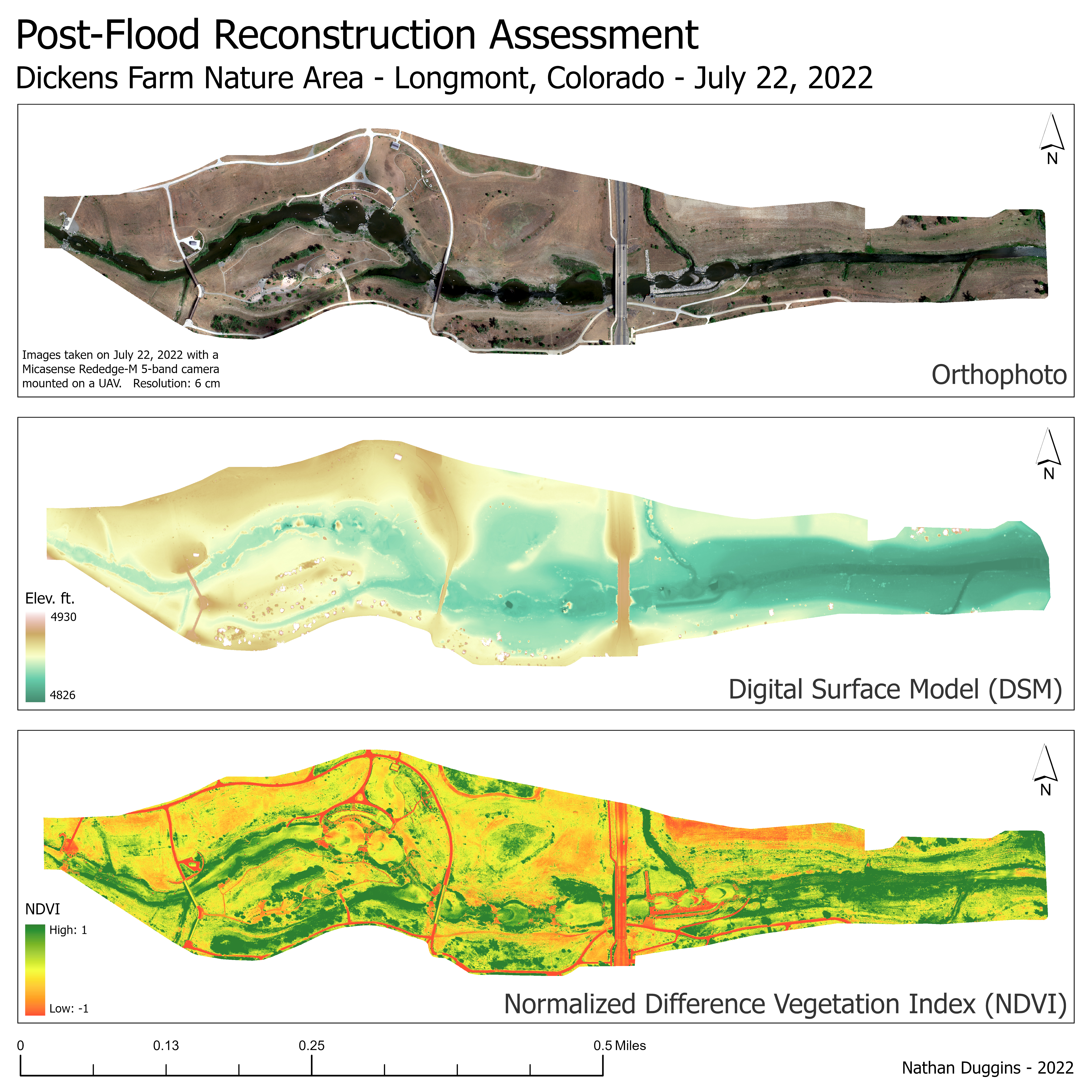
I partnered with University of Northern Colorado researchers and the city of Longmont to conduct a post-disaster reconstruction assessment of the St. Vrain Creek using high-resolution geospatial data. This work established baseline datasets comparing human-centered infrastructure redevelopment against ecologically focused habitat restoration, providing quantitative evidence to guide future disaster recovery planning in the watershed following the 2013 flood.
- Conducted multispectral UAV surveys over a 2.25-mile stretch of the St. Vrain Creek corridor, including the Dicken’s Farm Nature Area and adjacent restoration zones
- Managed complete UAV workflow: mission planning, flight operations, data acquisition, and post-processing
- Used a Trimble R10 GNSS to establish centimeter-accurate ground control for long-term monitoring precision
- Produced high-resolution orthophotos, digital elevation models (DEMs), and NDVI layers for quantitative habitat and landform analysis using Agisoft Metashape and CloudCompare
- Delivered datasets now serving as baseline monitoring data for evaluating ecological recovery and reconstruction outcomes
- Provided a comparative framework enabling researchers to measure long-term ecological success and guide future riparian restoration and disaster-recovery planning
(Click to view full-resolution image)
×